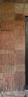
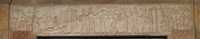
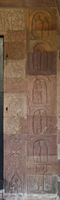
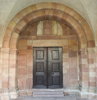
Andlau, Saints-Pierre-et-Paul (Sainte-Richarde)

Building Data for Andlau, Saints-Pierre-et-Paul (Sainte-Richarde)
- Type: Parish
- Affiliation:
- Region: Alsace
- Department: Bas-Rhin
- Coords: 48.387, 7.4149
- Surveyed: 2012
Zooms for Andlau, Saints-Pierre-et-Paul (Sainte-Richarde) - created by Chris Henige during our many trips to northern France.


There are no Virtual Tour results for this building.